


Orlando Offline Street Map app for iPhone and iPad
Developer: Networking 2.0
First release : 02 Jun 2009
App size: 27.57 Mb
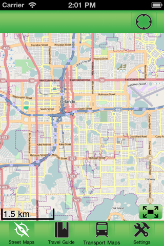
This app allows you to browse street level map of Orlando when you are traveling. You dont need to have internet connection for this to work as the map is stored on your iPhone or iPod Touch. Ideal for saving roaming charges or having to find the local wifi to access the built-in map application.
You can pinch to zoom in and out of the map just like you can with the built-in map application.
We are currently building and field testing support for GPS and this will be released as a free update soon. Stay tuned.
The source of the map is from Open Street Map, http://openstreetmap.com/ under Creative Commons Attribution-ShareAlike 2.0 license.
Follow us on Twitter.
http://twitter.com/ondemandworld
Latest reviews of Orlando Offline Street Map app for iPhone and iPad
Kept crashing! Plus it wouldnt even let me navigate to the different parts of the map, especially the southern part! It just kept moving to the NW!
The application Concept is Good, but it needs lot of improvisation to be responding quickly. Map of southern part does not show up, the current location doesnot load the map at all after long time.
Kept crashing. Couldnt even use it. Sorry. 0 of 5 stars.
Useless to me. Deleting.